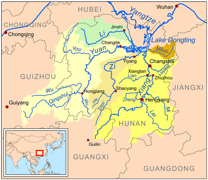
File:Dongtingriversmap.png
Appearance

Size of this preview: 690 × 599 pixels. Other resolutions: 276 × 240 pixels | 553 × 480 pixels | 885 × 768 pixels | 1,200 × 1,042 pixels.
Original file (1,200 × 1,042 pixels, file size: 488 KB, MIME type: image/png)
File history
Click on a date/time to view the file as it appeared at that time.
| Date/Time | Thumbnail | Dimensions | User | Comment | |
|---|---|---|---|---|---|
| current | 14:34, 4 January 2024 |  | 1,200 × 1,042 (488 KB) | Kmusser | Xiao Liuyang label fix |
| 00:06, 13 March 2009 |  | 1,200 × 1,042 (610 KB) | Kmusser | spelling fix | |
| 21:07, 12 March 2009 |  | 1,200 × 1,042 (611 KB) | Kmusser | {{Information |Description=This is a map of the major rivers flowing into Lake Dongting; the Xiang, Zi, Yuan, Li and Miluo rivers. |So |
File usage
The following 14 pages use this file:
Global file usage
The following other wikis use this file:
- Usage on af.wikipedia.org
- Usage on arz.wikipedia.org
- Usage on ast.wikipedia.org
- Usage on bg.wikipedia.org
- Usage on bn.wikipedia.org
- Usage on bo.wikipedia.org
- Usage on bs.wikipedia.org
- Usage on ceb.wikipedia.org
- Usage on cs.wikipedia.org
- Usage on cy.wikipedia.org
- Usage on da.wikipedia.org
- Usage on de.wikipedia.org
- Usage on eo.wikipedia.org
- Usage on es.wikipedia.org
- Usage on eu.wikipedia.org
- Usage on fa.wikipedia.org
- Usage on fi.wikipedia.org
- Usage on fr.wikipedia.org
View more global usage of this file.

