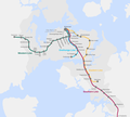
File:AucklandRailMap.png
Appearance

Size of this preview: 667 × 600 pixels. Other resolutions: 267 × 240 pixels | 534 × 480 pixels | 854 × 768 pixels | 1,139 × 1,024 pixels | 1,388 × 1,248 pixels.
Original file (1,388 × 1,248 pixels, file size: 226 KB, MIME type: image/png)
File history
Click on a date/time to view the file as it appeared at that time.
| Date/Time | Thumbnail | Dimensions | User | Comment | |
|---|---|---|---|---|---|
| current | 07:27, 23 October 2019 |  | 1,388 × 1,248 (226 KB) | VerySunday | Replaced Boston Rd with Grafton |
| 22:06, 16 March 2017 |  | 1,388 × 1,248 (232 KB) | Akld guy | Removed Westfield Railway Station; deleted dots at fare stage stations | |
| 19:36, 17 January 2016 |  | 1,388 × 1,248 (251 KB) | Vardion | moving two station names, as per request | |
| 05:07, 17 January 2016 |  | 1,388 × 1,248 (226 KB) | Vardion | distinguishing fare stations; shrinking Parnell dot | |
| 01:22, 17 January 2016 |  | 1,388 × 1,247 (221 KB) | Vardion | attempt to update (having had to recreate image due to not having original file immediately available) | |
| 06:08, 10 August 2008 |  | 1,392 × 1,249 (247 KB) | Vardion | ||
| 08:00, 16 March 2008 |  | 1,392 × 1,249 (254 KB) | Vardion | {{Information |Description=Map of the Auckland railway network (revised according to suggestions) |Source=self-made |Date=16 March 2008 |Author= Vardion |Permission= |other_versions= }} | |
| 00:54, 15 March 2008 |  | 1,718 × 2,060 (336 KB) | Vardion | {{Information |Description=Map of the Auckland railway network |Source=Self-made |Date=15 March 2008 |Author=Vardion (the uploader) |Permission= |other_versions= }} |
File usage
The following 7 pages use this file:
Global file usage
The following other wikis use this file:
- Usage on es.wikipedia.org
- Usage on fr.wikipedia.org
- Usage on pt.wikipedia.org
- Usage on www.wikidata.org
- Usage on zh.wikipedia.org


