Jennings, Antigua and Barbuda
Appearance
This article needs additional citations for verification. (April 2023) |
Jennings | |
|---|---|
Village | |
 A view of the towns of Bolands and Jennings | |
 | |
| Coordinates: 17°05′N 61°52′W / 17.083°N 61.867°W | |
| Country | Antigua and Barbuda |
| Island | Antigua |
| Civil parish | Saint Mary Parish |
| Time zone | UTC-4 (AST) |
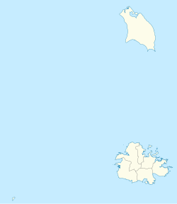
Jennings is a small settlement[citation needed] in Saint Mary Parish on the island of Antigua, in Antigua and Barbuda.[1] It is located in the west of the island. The town is on the road between the capital city St. John's and the town of Bolans, and some three kilometres from Five Island Harbour on the west coast.[citation needed]
References

