List of settlements in Cheshire by population
Appearance
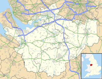
This is a list of settlements in Cheshire by population based on the results of the 2011 census. The next United Kingdom census will take place in 2021. In 2011, there were 25 built-up area subdivisions with 5,000 or more inhabitants in Cheshire, shown in the table below.
Population ranking
| # | Settlement | Local Government council area | Population (2001)[1][2][3][4] | Population (2011)[5] |
|---|---|---|---|---|
| 1 | Warrington | Warrington | 157,860 | 165,456 |
| 2 | Chester | Cheshire West and Chester | 81,650 | 118,200 |
| 3 | Northwich | Cheshire West and Chester | 42,820 | 75,250 |
| 4 | Crewe | Cheshire East | 67,760 | 71,722 |
| 5 | Runcorn | Halton | 60,320 | 61,789 |
| 6 | Widnes | Halton | 55,680 | 61,464 |
| 7 | Ellesmere Port | Cheshire West and Chester | 62,510 | 55,715 |
| 8 | Macclesfield | Cheshire East | 54,440 | 52,044 |
| 9 | Winsford | Cheshire West and Chester | 29,440 | 30,481 |
| 10 | Congleton | Cheshire East | 25,510 | 26,178 |
| 11 | Wilmslow | Cheshire East | 34,090 | 24,497 |
| 12 | Sandbach | Cheshire East | 17,630 | 17,976 |
| 13 | Nantwich | Cheshire East | 13,450 | 17,226 |
| 14 | Poynton | Cheshire East | 15,442 | 15,282 |
| 15 | Neston | Cheshire West and Chester | 15,018 | 15,064 |
| 16 | Middlewich | Cheshire East | 13,100 | 13,595 |
| 17 | Alsager | Cheshire East | 14,178 | 13,347 |
| 18 | Knutsford | Cheshire East | 12,656 | 13,191 |
| 19 | Lymm | Warrington | 9,830 | 11,608 |
| 20 | Frodsham | Cheshire West and Chester | 8,908 | 9,032 |
| 21 | Bollington | Cheshire East | 6,880 | 7,373 |
| 22 | Culcheth | Warrington | 6,730 | 6,708 |
| 23 | Weaverham | Cheshire West and Chester | 6,293 | 6,087 |
| 24 | Holmes Chapel | Cheshire East | 5,669 | 5,605 |
| 25 | Helsby | Cheshire West and Chester | 4,911 | 5,166 |
| Haslington | Cheshire East | 5,075 | 4,855 |
See also
References
- ^ "Warrington (Unitary District, North West England, United Kingdom) – Population Statistics, Charts, Map and Location". www.citypopulation.de.
- ^ "Cheshire West and Chester (Unitary District, North West England, United Kingdom) – Population Statistics, Charts, Map and Location". www.citypopulation.de.
- ^ "Cheshire East (Unitary District, North West England, United Kingdom) – Population Statistics, Charts, Map and Location". www.citypopulation.de.
- ^ "Halton (Unitary District, North West England, United Kingdom) – Population Statistics, Charts, Map and Location". www.citypopulation.de.
- ^ 2011 census table: ONS

