Syrym District
Appearance
Syrym
Сырым | |
|---|---|
District | |
| Сырым ауданы | |
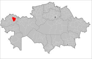
 Location of Syrym District in Kazakhstan | |
| Country | |
| Region | West Kazakhstan Region |
| Administrative center | Zhympity |
| Population (2013)[1] | |
• Total | 20,652 |
| Time zone | UTC+5 (West) |
Syrym (Kazakh: Сырым ауданы, Syrym audany) is a district of West Kazakhstan Region in western Kazakhstan. The administrative center of the district is the auyl of Zhympity.[2] Population: 20,652 (2013 estimate);[1] 21,575 (2009 Census results);[3] 30,569 (1999 Census results).[3]
History
[edit]It was formed as the Dzhambeytinsky district. In 1992, it was renamed Syrymsky district in honor of batyr Syrym Datov.[4]
Geography
[edit]Syrym District lies in a flat area north of the Caspian Depression. The Buldyrty (Бұлдырты) and Olenti rivers flow across the territory of the district.[5][6]
References
[edit]- ^ a b "Население Республики Казахстан" (in Russian). Департамент социальной и демографической статистики. Retrieved 27 December 2013.
- ^ www.geonames.de Subdivisions of Kazakhstan in local languages
- ^ a b "Население Республики Казахстан" [Population of the Republic of Kazakhstan] (in Russian). Департамент социальной и демографической статистики. Retrieved 8 December 2013.
- ^ "О переименовании Джамбейтинского района Западно-Казахстанской области в Сырымский район". adilet.zan.kz. 1992-09-24.
- ^ "M-39 Topographic Chart (in Russian)". Retrieved 23 February 2023.
- ^ Google Earth
50°15′00″N 52°33′36″E / 50.25000°N 52.56000°E

