Packington, Quebec
Appearance
Packington | |
|---|---|
 | |
 Location within Témiscouata RCM | |
| Coordinates: 47°29′N 68°47′W / 47.483°N 68.783°W[1] | |
| Country | |
| Province | |
| Region | Bas-Saint-Laurent |
| RCM | Témiscouata |
| Constituted | October 6, 1925 |
| Named for | John Pakington, 1st Baron Hampton[1] |
| Government | |
| • Mayor | Emilien Beaulieu |
| • Federal riding | Rimouski-Neigette— Témiscouata—Les Basques |
| • Prov. riding | Rivière-du-Loup-Témiscouata |
| Area | |
• Total | 123.30 km2 (47.61 sq mi) |
| • Land | 118.75 km2 (45.85 sq mi) |
| Population | |
• Total | 578 |
| • Density | 4.9/km2 (13/sq mi) |
| • Pop 2016-2021 | |
| • Dwellings | 419 |
| Time zone | UTC−5 (EST) |
| • Summer (DST) | UTC−4 (EDT) |
| Postal code(s) | |
| Area code(s) | 418 and 581 |
| Highways | No major routes |
| Website | www |
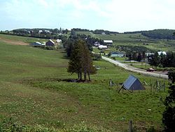
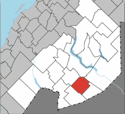
Packington is a parish municipality in the Canadian province of Quebec, located in the Témiscouata Regional County Municipality in the Bas-Saint-Laurent region.
History
The Municipality was founded in 1925 under the name Saint-Benoît-Abbé. In 1972, the name was changed to Packington, a name that was originally used to name this territory.
Pakington was one of the organizing communities of the 5th Acadian World Congress in 2014.[4]
Demographics
In the 2021 Census of Population conducted by Statistics Canada, Packington had a population of 578 living in 273 of its 419 total private dwellings, a change of -4.1% from its 2016 population of 603. With a land area of 118.75 km2 (45.85 sq mi), it had a population density of 4.9/km2 (12.6/sq mi) in 2021.[5]
See also
- Temiscouata Regional County Municipality
- Branche à Jerry, a stream
- Baker River North (Quebec-New Brunswick), au stream
- List of parish municipalities in Quebec
References
- ^ a b "Banque de noms de lieux du Québec: Reference number 72495". toponymie.gouv.qc.ca (in French). Commission de toponymie du Québec.
- ^ a b "Répertoire des municipalités: Geographic code 13015". www.mamh.gouv.qc.ca (in French). Ministère des Affaires municipales et de l'Habitation.
- ^ a b "Profile table, Census Profile, 2021 Census of Population - Packington, Paroisse (Municipalité de) (PE) [Census subdivision], Quebec". 9 February 2022.
- ^ https://www.cma2014.com/images/programmation/prog_CMA2014Web.pdf [bare URL PDF]
- ^ "Population and dwelling counts: Canada, provinces and territories, and census subdivisions (municipalities), Quebec". Statistics Canada. February 9, 2022. Retrieved August 29, 2022.
External links
 Media related to Packington, Quebec at Wikimedia Commons

