Ukiangong Point
Appearance


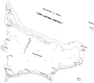
Ukiangong Point is the southwesternmost point on Butaritari atoll located in the Pacific Ocean island nation of Kiribati. It is located on the islet of Tabonohobi.
World War II
[edit]Ukiangong Point was fired upon by the USS Nautilus shortly after 7 AM on August 17, 1942, after the submarine and the USS Argonaut had dropped Lieutenant Colonel Evans F. Carlson's Marine Raiders on the ocean side of Butaritari Island as part of the Makin Raid.[1] Later in the war, the capture of Ukiangong point was an early objective in the U.S. Army's assault on Butaritari on November 20, 1943.[2]
Notes
[edit]References
[edit]- Hough, Frank O.; Verle E. Ludwig; Henry I. Shaw Jr (1958). Pearl Harbor To Guadalcanal, History Of The Marine Corps Operations In World War II, Volume I. Washington, D.C.: United States Marine Corps.
- Crowl, Philip A.; Edmund G. Love (1955). Seizure of the Gilberts and Marshalls, United States Army in World War II: The War in the Pacific. Washington, D.C.: United States Army.
3°2′22″N 172°45′30″E / 3.03944°N 172.75833°E
