Knott End-on-Sea
Appearance
Knott End-on-Sea
| |
|---|---|
 Knott End Methodist Church | |
Location within Lancashire | |
| OS grid reference | SD358483 |
| Civil parish | |
| District | |
| Shire county | |
| Region | |
| Country | England |
| Sovereign state | United Kingdom |
| Post town | POULTON-LE-FYLDE |
| Postcode district | FY6 |
| Dialling code | 01253 |
| Police | Lancashire |
| Fire | Lancashire |
| Ambulance | North West |
| UK Parliament | |
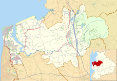
Knott End-on-Sea is a village in Lancashire, England, on the southern side of Morecambe Bay, across the Wyre estuary from Fleetwood. Knott End has a pub, the Bourne Arms, county library and golf club. Buses run regularly from Knott End and there is also a three-minute ferry crossing to Fleetwood.
Knott End also has two clubs, The Squash and Knott End Working Men's Club.


