Kikorongo–Ishaka Road: Difference between revisions
Appearance
Content deleted Content added
←Created page with '{{inuse}} {{Use dmy dates|date=May 2016}} {{Infobox road |country= UGA |type= |route= |name= Kikorongo–Ishaka Road |length_mi=52 |length_round= |length_ref=...' |
→Location: typo |
||
| Line 22: | Line 22: | ||
==Location== |
==Location== |
||
The coordinates of the road near Rubirizi are 0°16'37.0"S, 30°06'27.0"E (Latitude:-0.276949; Longitude:30.107488).<ref>{{google |
The coordinates of the road near Rubirizi are 0°16'37.0"S, 30°06'27.0"E (Latitude:-0.276949; Longitude:30.107488).<ref>{{google maps| |
||
url=https://www.google.com/maps/place/0%C2%B016'37.0%22S+30%C2%B006'27.0%22E/@-0.2799311,30.0939706,13.75z/data=!4m5!3m4!1s0x0:0x0!8m2!3d-0.276949!4d30.107488 |title= Location of Kikorongo–Ishaka Road| |
url=https://www.google.com/maps/place/0%C2%B016'37.0%22S+30%C2%B006'27.0%22E/@-0.2799311,30.0939706,13.75z/data=!4m5!3m4!1s0x0:0x0!8m2!3d-0.276949!4d30.107488 |title= Location of Kikorongo–Ishaka Road| |
||
accessdate=21 May 2016}}</ref> |
accessdate=21 May 2016}}</ref> |
||
Revision as of 17:26, 21 May 2016
This article is actively undergoing a major edit for a little while. To help avoid edit conflicts, please do not edit this page while this message is displayed. This page was last edited at 17:26, 21 May 2016 (UTC) (8 years ago) – this estimate is cached, . Please remove this template if this page hasn't been edited for a significant time. If you are the editor who added this template, please be sure to remove it or replace it with {{Under construction}} between editing sessions. |
| Kikorongo–Ishaka Road | |
|---|---|
| Route information | |
| Length | 52 mi (84 km) |
| Major junctions | |
| North end | Kikorongo |
| Katunguru Rubirizi | |
| South end | Ishaka |
| Location | |
| Country | Uganda |
| Highway system | |
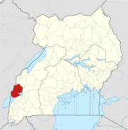
Kikorongo–Ishaka Road is a road in the Western Region of Uganda, connecting the towns of Kikorongo in Kasese District with Ishaka in Bushenyi District.
Location
The coordinates of the road near Rubirizi are 0°16'37.0"S, 30°06'27.0"E (Latitude:-0.276949; Longitude:30.107488).[1]
Overview
See also
References
- ^ "Location of Kikorongo–Ishaka Road" (Map). Google Maps. Retrieved 21 May 2016.
External links


