El Toro Y: Difference between revisions
WhisperToMe (talk | contribs) |
WhisperToMe (talk | contribs) |
||
| Line 44: | Line 44: | ||
==External links== |
==External links== |
||
* {{Commons category-inline}} |
* {{Commons category-inline}} |
||
{{Irvine, California}} |
|||
{{coord|33.6446|-117.7353|type:landmark_region:US|format=dms|display=title}} |
{{coord|33.6446|-117.7353|type:landmark_region:US|format=dms|display=title}} |
||
Revision as of 19:53, 13 July 2015
This article needs additional citations for verification. (July 2008) |
| El Toro "Y" | |
|---|---|
| El Toro Interchange, The "Y" | |
 | |
 | |
| Location | |
| Irvine, California | |
| Roads at junction | |
| Construction | |
| Maintained by | Caltrans |
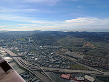
The El Toro "Y" is a freeway interchange in southern Orange County, California where the Santa Ana Freeway, Interstate 5 (I-5), and the San Diego Freeway, the I-405 merge. South of that point, it retains the name "San Diego Freeway" but with the highway designation "I-5." Located in south Orange County where the cities of Lake Forest, Laguna Hills, and Irvine converge, the interchange was named after the city (El Toro - now Lake Forest) and the now closed Marine Corps Air Station El Toro, located northeast of the interchange.
The "Y" is one of the busiest interchanges in the world; from 1975 to 2002, daily traffic surged from 102,000 to 356,000 vehicles a day.[1]
History
This section needs additional citations for verification. (December 2013) |

By the early 1990s the El Toro Y had become one of the most congested freeway interchanges in the world, its severe overcrowding fed by a housing boom in southern Orange County.
In November 1990, Orange County voters approved Measure M, a half-cent increase in the county sales tax to finance transportation improvements. In 1993, the California Department of Transportation (Caltrans) began a massive expansion project,[2] adding a new interchange and collector/distributor roads at Bake Parkway (signed as truck bypass lanes) and Lake Forest Drive, and carpool lanes and connectors. The $166-million project also vastly increased regular traffic lanes. After the project was completed in 1997, the El Toro Y stood as one of the widest roads in the world, at 26 traffic lanes wide.
The traffic delays at the interchange sparked the construction of several parallel bypass toll roads. The San Joaquin Hills Toll Road, designated State Route 73 (SR 73), opened in November 1996 and connects San Juan Capistrano and Costa Mesa. An extension to SR 241, the Foothill Toll Road, is under development. It would bypass the El Toro Y to the east and connect to I-5 in northern San Diego County.
In the cleft of the Y lies the Irvine Spectrum Center, a large shopping center which includes a movie theater, numerous shopping destinations and a large obelisk, which conceals a cell phone and television tower inside of it.
On July 29, 2008 a moderate earthquake centered in Chino Hills caused damage to an expansion joint on one of the overpasses in the interchange. Caltrans closed the 5 Southbound Truck Bypass/Bake Parkway/Lake Forest exit, to replace the expansion joint that was damaged during the quake.[3]
Some of the big engineering firms which have worked on El Toro Y over a period of time are Moffatt & Nichol and RTEA.
See also
References
- ^ Weikel, Dan (July 5, 2004). "The Road More Heavily Traveled". Los Angeles Times.
- ^ ROMERO, FERNANDO (Dec 22, 1993). "Widening Work Begins on Crowded El Toro 'Y'". Los Angeles Times.
- ^ Irving, Doug (July 29, 2008). "O.C. Quake Roundup: Cal State Fullerton damaged; trains disrupted for a bit". Orange County Register.
External links
 Media related to El Toro Y at Wikimedia Commons
