Walton Township, Harvey County, Kansas: Difference between revisions
Appearance
Content deleted Content added
→External links: add |
quick cleanup |
||
| Line 79: | Line 79: | ||
|blank_name = [[Geographic Names Information System|GNIS]] feature ID |
|blank_name = [[Geographic Names Information System|GNIS]] feature ID |
||
|blank_info = [http://geonames.usgs.gov/pls/gnispublic/f?p=gnispq:3:::NO::P3_FID:0477771 0477771] |
|blank_info = [http://geonames.usgs.gov/pls/gnispublic/f?p=gnispq:3:::NO::P3_FID:0477771 0477771] |
||
|website = |
|website = [http://www.HarveyCounty.com/ County Website] |
||
|footnotes = |
|footnotes = |
||
}} |
}} |
||
| Line 86: | Line 86: | ||
==Geography== |
==Geography== |
||
Walton Township covers an area of {{convert|36.69|sqmi|km2}} and contains one incorporated settlement, [[Walton, Kansas|Walton]]. According to the [[United States Geological Survey|USGS]], it contains one cemetery, Walton. |
Walton Township covers an area of {{convert|36.69|sqmi|km2}} and contains one incorporated settlement, [[Walton, Kansas|Walton]]. |
||
==Cemeteries== |
|||
According to the [[United States Geological Survey|USGS]], it contains one cemetery, Walton. |
|||
==Further reading== |
==Further reading== |
||
;Harvey County |
|||
* [http://www.kansasmemory.org/item/223955/ ''Standard Atlas of Harvey County, Kansas'']; Geo. A. Ogle & Co; 70 pages; 1918. |
* [http://www.kansasmemory.org/item/223955/ ''Standard Atlas of Harvey County, Kansas'']; Geo. A. Ogle & Co; 70 pages; 1918. |
||
* [http://www.kansasmemory.org/item/209389/ ''Plat Book of Harvey County, Kansas'']; North West Publishing Co; 34 pages; 1902. |
* [http://www.kansasmemory.org/item/209389/ ''Plat Book of Harvey County, Kansas'']; North West Publishing Co; 34 pages; 1902. |
||
| Line 95: | Line 97: | ||
==References== |
==References== |
||
{{Reflist}} |
|||
* [http://geonames.usgs.gov/domestic/index.html USGS Geographic Names Information System (GNIS)] |
|||
==External links== |
==External links== |
||
* [http://www. |
* [http://www.HarveyCounty.com/ Harvey County Website] |
||
* Harvey County Maps: [http://www.ksdot.org/burtransplan/maps/county-pdf/harvey.PDF Current], [http://www.ksdot.org/burTransPlan/maps/PastPublishedCounty/harvey1941.PDF 1941] |
* Harvey County Maps: [http://www.ksdot.org/burtransplan/maps/county-pdf/harvey.PDF Current], [http://www.ksdot.org/burTransPlan/maps/PastPublishedCounty/harvey1941.PDF 1941] |
||
{{-}} |
{{-}} |
||
Revision as of 13:44, 17 May 2014
Walton Township | |
|---|---|
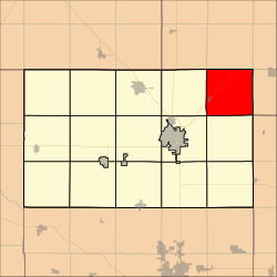
 Location in Harvey County | |
| Country | United States |
| State | Kansas |
| County | Harvey |
| Area | |
• Total | 36.69 sq mi (95.02 km2) |
| • Land | 36.66 sq mi (94.96 km2) |
| • Water | 0.02 sq mi (0.06 km2) 0.06% |
| Elevation | 1,483 ft (452 m) |
| Population (2000) | |
• Total | 552 |
| • Density | 15.1/sq mi (5.8/km2) |
| GNIS feature ID | 0477771 |
| Website | County Website |
Walton Township is a township in Harvey County, Kansas, USA. As of the 2000 census, its population was 552.
Geography
Walton Township covers an area of 36.69 square miles (95.0 km2) and contains one incorporated settlement, Walton.
Cemeteries
According to the USGS, it contains one cemetery, Walton.
Further reading
- Standard Atlas of Harvey County, Kansas; Geo. A. Ogle & Co; 70 pages; 1918.
- Plat Book of Harvey County, Kansas; North West Publishing Co; 34 pages; 1902.
- Historical Atlas of Harvey County, Kansas; 33 pages; John P. Edwards; 1882.
References
External links
- Harvey County Website
- Harvey County Maps: Current, 1941

