Porterville, Kansas: Difference between revisions
Appearance
Content deleted Content added
→top: add "use mdy dates" template |
→top: per gnis |
||
| Line 64: | Line 64: | ||
|area_code = [[Area code 620|620]] |
|area_code = [[Area code 620|620]] |
||
|blank_name = [[Federal Information Processing Standard|FIPS code]] |
|blank_name = [[Federal Information Processing Standard|FIPS code]] |
||
|blank_info = 20-57075 |
|blank_info = 20-57075 |
||
|blank1_name = [[Geographic Names Information System|GNIS ID]] |
|blank1_name = [[Geographic Names Information System|GNIS ID]] |
||
|blank1_info = 484706 |
|blank1_info = 484706<ref name="GNIS">{{GNIS|484706}}</ref> |
||
|website = |
|website = |
||
}} |
}} |
||
Latest revision as of 01:18, 22 September 2023
Porterville, Kansas | |
|---|---|
 | |
| Coordinates: 37°43′05″N 95°04′08″W / 37.71806°N 95.06889°W[1] | |
| Country | United States |
| State | Kansas |
| County | Bourbon |
| Elevation | 1,011 ft (308 m) |
| Time zone | UTC-6 (CST) |
| • Summer (DST) | UTC-5 (CDT) |
| Area code | 620 |
| FIPS code | 20-57075 |
| GNIS ID | 484706[1] |
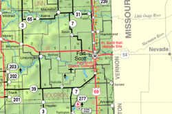
Porterville is an unincorporated community in Bourbon County, Kansas, United States.[1]
History
[edit]Porterville had a post office from 1882 until 1905.[2] L. G. Porter, the first postmaster, gave the community its name.[3]
References
[edit]- ^ a b c d U.S. Geological Survey Geographic Names Information System: Porterville, Kansas
- ^ "Kansas Post Offices, 1828-1961". Kansas Historical Society. Retrieved August 2, 2014.
- ^ "Many Towns Have Disappeared (Note: Page loads on 9C due to technical constraints. Scroll to next page)". The Fort Scott Tribune. July 16, 1976. pp. 10C. Retrieved May 16, 2015.
Further reading
[edit]External links
[edit]

