Laako: Difference between revisions
Appearance
Content deleted Content added
→See also: Is A bulleted list of internal links to related Wikipedia articles. |
Yamaguchi先生 (talk | contribs) m Reverted edits by 66.242.85.112 (talk) to last version by Hamzamj1 |
||
| (15 intermediate revisions by 9 users not shown) | |||
| Line 1: | Line 1: | ||
{{refimprove|date=February 2020}} |
|||
{{Infobox settlement |
{{Infobox settlement |
||
|official_name =Laako |
| official_name = Laako |
||
|other_name = |
| other_name = |
||
|native_name |
| native_name = |
||
|nickname = |
| nickname = |
||
|settlement_type =Town |
| settlement_type = Town |
||
|motto = |
| motto = |
||
|image_skyline = |
| image_skyline = |
||
|imagesize = |
| imagesize = |
||
|image_caption = |
| image_caption = |
||
|image_flag = |
| image_flag = |
||
|flag_size = |
| flag_size = |
||
|image_seal = |
| image_seal = |
||
|seal_size = |
| seal_size = |
||
|image_map = |
| image_map = |
||
|mapsize = |
| mapsize = |
||
|map_caption = |
| map_caption = |
||
|pushpin_map = |
| pushpin_map = Somaliland |
||
|pushpin_label_position =bottom |
| pushpin_label_position = bottom |
||
|pushpin_mapsize = |
| pushpin_mapsize = |
||
|pushpin_map_caption = |
| pushpin_map_caption = |
||
|subdivision_type =Country |
| subdivision_type = Country |
||
|subdivision_name ={{flag|Somaliland}} |
| subdivision_name = {{flag|Somaliland}} |
||
|subdivision_type1 =[[Administrative divisions of Somaliland|Region]] |
| subdivision_type1 = [[Administrative divisions of Somaliland|Region]] |
||
|subdivision_name1 =[[Sanaag]] |
| subdivision_name1 = [[Sanaag]] |
||
|subdivision_type2 = |
| subdivision_type2 = [[Administrative divisions of Somaliland|District]] |
||
|subdivision_name2 = |
| subdivision_name2 = [[Las Khorey District|Las Khorey]] |
||
|government_footnotes = |
| government_footnotes = |
||
|government_type = |
| government_type = |
||
|leader_title = |
| leader_title = |
||
|leader_name = |
| leader_name = |
||
|established_title |
| established_title = |
||
|established_date = |
| established_date = |
||
|area_magnitude = |
| area_magnitude = |
||
|unit_pref = |
| unit_pref = Metric |
||
|area_footnotes = |
| area_footnotes = |
||
|area_total_km2 = |
| area_total_km2 = |
||
|area_land_km2 = |
| area_land_km2 = |
||
|population_as_of = |
| population_as_of = |
||
|population_footnotes = |
| population_footnotes = |
||
|population_note = |
| population_note = |
||
|population_total = |
| population_total = |
||
|population_density_km2 = |
| population_density_km2 = |
||
|timezone =[[East Africa Time|EAT]] |
| timezone = [[East Africa Time|EAT]] |
||
|utc_offset =+3 |
| utc_offset = +3 |
||
|timezone_DST |
| timezone_DST = |
||
|utc_offset_DST = |
| utc_offset_DST = |
||
|coordinates = |
| coordinates = {{Coord|10.727|N|48.589|E|region:SO|display=inline,title}} |
||
|elevation_footnotes = |
| elevation_footnotes = |
||
|elevation_m = |
| elevation_m = |
||
|elevation_ft = |
| elevation_ft = |
||
|postal_code_type = |
| postal_code_type = |
||
|postal_code = |
| postal_code = |
||
|area_code = |
| area_code = |
||
|blank_name = |
| blank_name = |
||
|blank_info = |
| blank_info = |
||
|website = |
| website = |
||
|footnotes = |
| footnotes = |
||
| name = |
|||
}} |
}} |
||
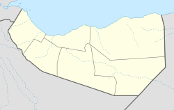
'''Laako''' is a |
'''Laako''' is a town located in the eastern [[Sanaag]] region of [[Somaliland]]. The city lies between [[Badhan, Sanaag|Badhan]] and [[El Ayo]]. |
||
==Overview== |
|||
Laako has grown since the outbreak of the [[Somali Civil War|civil war]]. There is a local hospital, and one primary and secondary school. |
|||
Local control is disputed between [[Somaliland]], a self-declared independent republic that is internationally [[Diplomatic recognition|recognized]] as an [[States and regions of Somalia|autonomous region]] of Somalia and the autonomous [[Puntland]] region in northeastern Somalia. |
|||
==See also== |
==See also== |
||
*[[Sanaag]] |
*[[Sanaag]] |
||
{{Portal|Somaliland}} |
|||
==References== |
==References== |
||
*[https://web.archive.org/web/20120330182223/http://www.faoswalim.org/downloads/shgr/WAT-REF-GRID-20090608-LAASQORAY-A3-001.pdf Laako] |
*[https://web.archive.org/web/20120330182223/http://www.faoswalim.org/downloads/shgr/WAT-REF-GRID-20090608-LAASQORAY-A3-001.pdf Laako] |
||
| ⚫ | |||
{{coord|10.7444|N|47.9194|E|source:wikidata|display=title}} |
|||
[[Category:Populated places in Sanaag]] |
[[Category:Populated places in Sanaag]] |
||
[[Category:Cities in |
[[Category:Cities in Maakhir]] |
||
[[Category:Geography of Somalia]] |
[[Category:Geography of Somalia]] |
||
[[Category:Archaeological sites in |
[[Category:Archaeological sites in Somalia]] |
||
| ⚫ | |||
Latest revision as of 21:24, 14 August 2024
This article needs additional citations for verification. (February 2020) |
Laako | |
|---|---|
Town | |
| Coordinates: 10°43′37″N 48°35′20″E / 10.727°N 48.589°E | |
| Country | |
| Region | Sanaag |
| District | Las Khorey |
| Time zone | UTC+3 (EAT) |
Laako is a town located in the eastern Sanaag region of Somaliland. The city lies between Badhan and El Ayo.

