Portal:U.S. roads/Selected picture: Difference between revisions
→2018: july |
set up for the rest of the year |
||
| (17 intermediate revisions by one other user not shown) | |||
| Line 439: | Line 439: | ||
===July=== |
===July=== |
||
{{/July 2018}} |
{{/July 2018}} |
||
===August=== |
|||
{{/August 2018}} |
|||
===September=== |
|||
{{/September 2018}} |
|||
===October=== |
|||
{{/October 2018}} |
|||
===November=== |
|||
{{/November 2018}} |
|||
===December=== |
|||
{{/December 2018}} |
|||
==2019== |
|||
===January and February=== |
|||
{{/January 2019}} |
|||
===March=== |
|||
{{/March 2019}} |
|||
===April=== |
|||
{{/April 2019}} |
|||
===May=== |
|||
{{/May 2019}} |
|||
===June=== |
|||
{{/June 2019}} |
|||
===July=== |
|||
{{/July 2019}} |
|||
===August=== |
|||
{{/August 2019}} |
|||
===September=== |
|||
{{/September 2019}} |
|||
===October and November=== |
|||
{{/October 2019}} |
|||
===December=== |
|||
{{/December 2019}} |
|||
==2020== |
|||
===January=== |
|||
{{/January 2020}} |
|||
===February=== |
|||
{{/February 2020}} |
|||
===March=== |
|||
{{/March 2020}} |
|||
===April=== |
|||
{{/April 2020}} |
|||
===May=== |
|||
{{/May 2020}} |
|||
===June=== |
|||
{{/June 2020}} |
|||
===July=== |
|||
{{/July 2020}} |
|||
===August=== |
|||
{{/August 2020}} |
|||
===September=== |
|||
{{/September 2020}} |
|||
===October=== |
|||
{{/October 2020}} |
|||
===November=== |
|||
{{/November 2020}} |
|||
===December=== |
|||
{{/December 2020}} |
|||
Latest revision as of 16:06, 3 April 2020
Previously selected pictures of the U.S. Roads Portal. To nominate a picture, follow the directions here.
2006
[edit]February
[edit]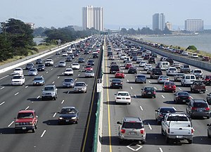
Interstate 80 is a major urban freeway though the East Bay, north of the Bay Bridge, in the San Francisco Bay Area (seen here in Berkeley, California).
March
[edit]
Northbound, Interstate 15 makes a steep descent from Mountain Pass into the Ivanpah Valley. In the middle distance, the casinos of Primm straddle the freeway right at the Nevada border, while those of Jean are further off, to the left; Las Vegas is immediately on the far side of the hills on the horizon.
Recently selected: Interstate 80
April
[edit]
The Dalton Highway and the Alaska Pipeline run generally parallel to each other; this segment is between the Arctic Circle and Coldfoot.
Recently selected: Interstate 15 • Interstate 80
May
[edit]
Signposts for Nevada's State Route 206 and State Route 207, in front of Jobs Peak of the Carson Range.
Recently selected: Dalton Highway • Interstate 15 • Interstate 80
June
[edit]
U.S. Route 50 in the desert of Nevada. This section is nicknamed the "Loneliest Road in America".
Recently selected: Nevada State Routes • Dalton Highway • Interstate 15
- Note: Was left as selected picture until March 2007.
2007
[edit]April
[edit]
Hairpin curve on U.S. Route 44 and New York State Route 55 near Gardiner, New York.
Recently selected: U.S. Route 50 in Nevada • Nevada State Routes • Dalton Highway
May
[edit]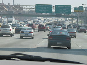
Heavy congestion on Interstate 495 eastbound in Queens.
Recently selected: U.S. Route 44 and New York State Route 55 • U.S. Route 50 in Nevada • Nevada State Routes
- Note: Was left as selected picture until June 2007.
July
[edit]
The Columbia–Wrightsville Bridge over the Susquehanna River.
Recently selected: Interstate 495 (New York) • U.S. Route 44 and New York State Route 55 • U.S. Route 50 in Nevada
August
[edit]
The Hawks' Nest on New York State Route 97 adjacent to the Delaware River.
Recently selected: Columbia–Wrightsville Bridge • Interstate 495 (New York) • U.S. Route 44 and New York State Route 55
September
[edit]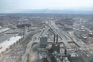
The South Bay Interchange in Boston, Massachusetts.
Recently selected: The Hawks' Nest • Columbia–Wrightsville Bridge • Interstate 495 (New York)
October
[edit]
U.S. Route 9W in the town of Cornwall, New York as seen from the summit of Butter Hill.
Recently selected: South Bay Interchange • The Hawks' Nest • Columbia–Wrightsville Bridge
November
[edit]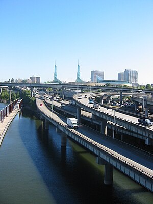
Interstate 84 and Interstate 5 meet near the Willamette River in Portland, Oregon.
Recently selected: Butter Hill • South Bay Interchange • The Hawks' Nest
December
[edit]
The four-lane Foresthill Bridge over the was built in 1971 to replace the low crossing of the American River on State Route 49 in preparation for the construction of the Auburn Dam. The dam was canceled for environmental reasons, but the bridge, the tallest in California, remains along the local Foresthill Road.
Recently selected: Interstate 84/Interstate 5 interchange • Butter Hill • South Bay Interchange
2008
[edit]January
[edit]
This is the Interstate 10 and Interstate 45 interchange in Houston, Texas.
Recently selected: Foresthill Bridge • Interstate 84/Interstate 5 interchange • Butter Hill
February
[edit]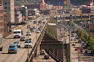
The Alaskan Way Viaduct in Seattle.
Recently selected: Interstate 10/Interstate 45 interchange • Foresthill Bridge • Interstate 84/Interstate 5 interchange
March
[edit]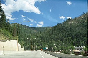
Interstate 90 in Wallace, Idaho, site of one of the final traffic lights to be removed from I-90.
Recently selected: Alaskan Way Viaduct • Interstate 10/Interstate 45 interchange • Foresthill Bridge
April 1 (April Fool's Day)
[edit]
M-28 in Schoolcraft County, Michigan, a 27-mile (43 km) segment of "straight as an arrow" highway.
Recently selected: Interstate 90 in Wallace, Idaho • Alaskan Way Viaduct • Interstate 10/Interstate 45 interchange
April
[edit]
Pasadena Freeway in Elysian Park, with the Figueroa Street Tunnels on the left.
Recently selected: Interstate 90 in Wallace, Idaho • Alaskan Way Viaduct • Interstate 10/Interstate 45 interchange
May
[edit]
Interstate 70 in Colorado in Glenwood Canyon.
Recently selected: Pasadena Freeway • Interstate 90 in Wallace, Idaho • Alaskan Way Viaduct
June
[edit]
A sign gantry removed from its normal position above I-35 in Norman, Oklahoma, and lying in the right-of-way between the Interstate and its service road. The support which the sign is typically mounted on is visible in the background.
Recently selected: Interstate 70 in Colorado • Pasadena Freeway • Interstate 90 in Wallace, Idaho
July
[edit]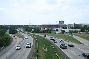
North Carolina Highway 147 passing through downtown Durham viewed from the Fayetteville St overpass.
Recently selected: Sign gantry downed in Oklahoma • Interstate 70 in Colorado • Pasadena Freeway
August
[edit]
A 1948 plan showing San Francisco's trafficways, which would later become the freeways and major streets in the city.
Recently selected: North Carolina Highway 147 • Sign gantry downed in Oklahoma • Interstate 70 in Colorado
September
[edit]
Interstate 5 curving through Downtown Seattle's skyline.
Recently selected: Trafficways in San Francisco • North Carolina Highway 147 • Sign gantry downed in Oklahoma
October
[edit]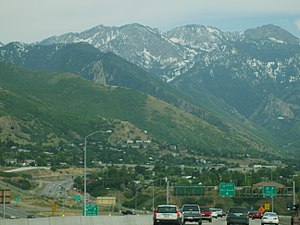
The terminus of Utah SR-186 at the junction with I-215 and I-80.
Recently selected: Interstate 5 in Seattle • Trafficways in San Francisco • North Carolina Highway 147
November
[edit]
A mileage sign along K-99 in Emporia, Kansas. KDOT uses demountable copy for most of its large road signs.
Recently selected: Utah State Route 186 • Interstate 5 in Seattle • Trafficways in San Francisco
December
[edit]
The Grandview Triangle in Kansas City, Missouri.
Recently selected: K-99 in Emporia, Kansas • Utah State Route 186 • Interstate 5 in Seattle
2009
[edit]January
[edit]
A single building settlement called Middlegate, Nevada, at the junction of U.S. Route 50 and Nevada State Route 361, that has served as a stopover for travelers since the pony express era of the 1800's. This portion of US 50 is colloquially known as "The Loneliest Road in America".
Recently selected: Grandview Triangle • K-99 in Emporia, Kansas • Utah State Route 186
February
[edit]
Interstate 287 interchange with the New York State Thruway in Suffern, New York
Recently selected: Middlegate, Nevada • Grandview Triangle • K-99 in Emporia, Kansas
March
[edit]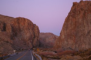
Nevada State Route 208 following the Walker River towards Yerington, Nevada.
Recently selected: Suffern interchange • Middlegate, Nevada • Grandview Triangle
April 1 (April Fool's Day)
[edit]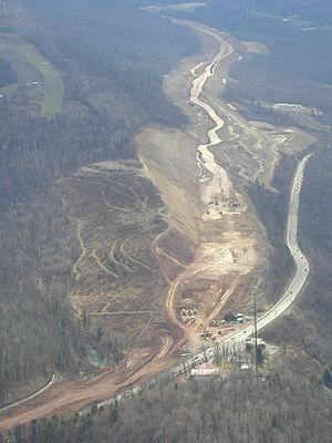
Interstate 99 excavation in 2002, looking south from Julian toward Port Matilda on Bald Eagle Mountain, where acidic rock was exposed. U.S. Route 322/220 (Skytop Mountain Road), runs below the I-99 alignment. Eagle Field private airport is at the upper left.
Recently selected: Nevada State Route 208 • Suffern interchange • Middlegate, Nevada
April
[edit]
Picture of Rainbow Bridge linking the United States and Canada; Niagara Falls, NY in background.
Recently selected: Nevada State Route 208 • Suffern interchange • Middlegate, Nevada
May
[edit]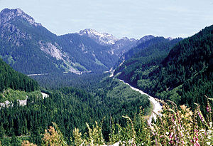
A view of Interstate 90 in Washington as it passes through Snoqualmie Pass.
Recently selected: Rainbow Bridge • Nevada State Route 208 • Suffern interchange
June
[edit]
A panoramic view of The Hite Crossing Bridge, which carries Utah State Route 95 across the Colorado River.
Recently selected: Interstate 90 through Snoqualmie Pass • Rainbow Bridge • Nevada State Route 208
July
[edit]
New York State Route 258 passing through fields in rural Livingston County, New York. This portion of NY 258 serves as a boundary between two towns; the town of Groveland is on the left and the town of West Sparta is on the right.
Recently selected: The Hite Crossing Bridge • Interstate 90 through Snoqualmie Pass • Rainbow Bridge
August
[edit]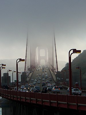
A view of the Golden Gate Bridge during a foggy day.
Recently selected: New York State Route 258 • The Hite Crossing Bridge • Interstate 90 through Snoqualmie Pass
September
[edit]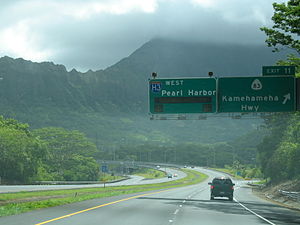
Westbound on Interstate H-3 heading toward Honolulu. Pu'ukahuauli Summit is in the background.
Recently selected: Golden Gate Bridge • New York State Route 258 • The Hite Crossing Bridge
October
[edit]
Eastbound on Pennsylvania Route 248 near Palmerton, Pennsylvania. The large mountains in the background are part of the Blue Mountain ridge; Lehigh Gap is to their right.
Recently selected: Interstate H-3 • Golden Gate Bridge • New York State Route 258
November
[edit]
Missouri Route 266 from Route Z in Halltown, just east of Route 266's terminus at Route 96.
Recently selected: Pennsylvania Route 248 • Interstate H-3 • Golden Gate Bridge
December
[edit]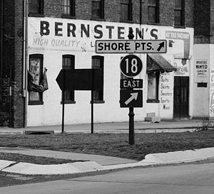
A photo from 1960 showing a sign assembly along Route 27 for Route 18 in New Brunswick, New Jersey. At the time, Route 18 was signed as east–west; it is now posted as north–south.
Recently selected: Missouri Route 266 • Pennsylvania Route 248 • Interstate H-3
2010
[edit]January
[edit]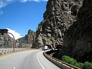
Western portal of the Hanging Lake Tunnel in Glenwood Canyon along Interstate 70 in Colorado.
Recently selected: New Jersey Route 18 • Missouri Route 266 • Pennsylvania Route 248
February
[edit]
Interstate 5 southbound (top, left) and its express lanes (bottom, left) seen at the Mercer Street offramp in Downtown Seattle, Washington
Recently selected: Hanging Lake Tunnel • New Jersey Route 18 • Missouri Route 266
March
[edit]
The Pulga bridge along California State Route 70 which crosses the Feather River Route and the Feather River
Recently selected: Interstate 5 in Seattle • Hanging Lake Tunnel • New Jersey Route 18
April 1 (April Fool's Day)
[edit]
Interstate 173, complete with a 30 mph (48 km/h) speed limit sign in the background, shown here routed on a residential street in Clinton, New Jersey.
Recently selected: Pulga Bridge • Interstate 5 in Seattle • Hanging Lake Tunnel
April
[edit]
Sunset over Louisiana Highway 1040.
Recently selected: Pulga Bridge • Interstate 5 in Seattle • Hanging Lake Tunnel
May
[edit]
Looking west over Interstate 235 in Des Moines, Iowa, from the Edna M. Griffin Memorial Bridge.
Recently selected: Louisiana Highway 1040 • Pulga Bridge • Interstate 5 in Seattle
June
[edit]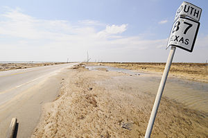
Recently selected: Interstate 235 • Louisiana Highway 1040 • Pulga Bridge
July
[edit]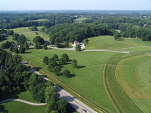
Recently selected: Texas State Highway 87 • Interstate 235 • Louisiana Highway 1040
August
[edit]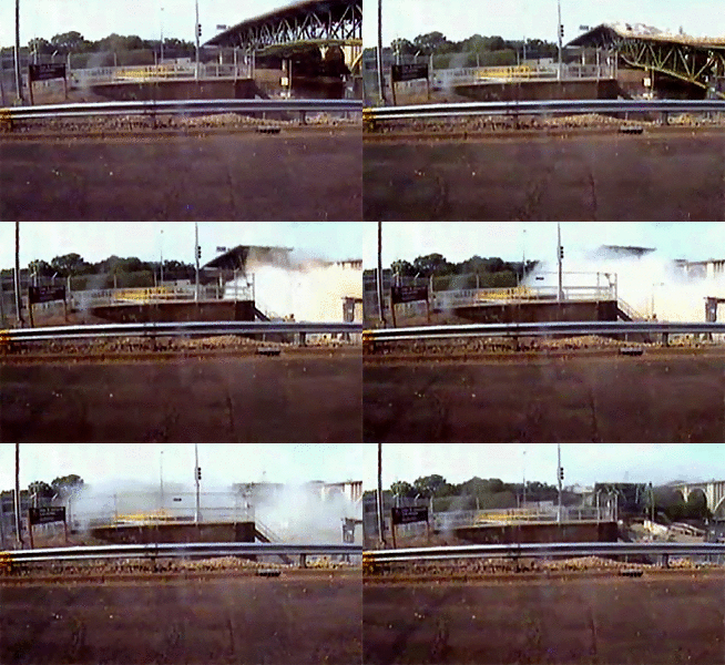
Recently selected: Delaware Route 52 • Texas State Highway 87 • Interstate 235
September
[edit]
Recently selected: I-35W Mississippi River bridge collapse video • Delaware Route 52 • Texas State Highway 87
October
[edit]
Recently selected: Puerto Rico Highway 139 • I-35W Mississippi River bridge collapse video • Delaware Route 52
November
[edit]The Tacoma Narrows Bridge was opened on July 1, 1940, and due to a physical phenomenon known as aeroelastic flutter the bridge collapsed on November 7, 1940, at 11:00 am (Pacific time).
Recently selected: U.S. Route 20A and New York State Route 15 • Puerto Rico Highway 139 • I-35W Mississippi River bridge collapse video
December
[edit]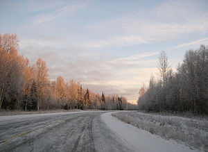
Recently selected: Tacoma Narrows bridge collapse video • U.S. Route 20A and New York State Route 15 • Puerto Rico Highway 139
2011
[edit]January
[edit]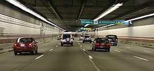
Recently selected: Parks Highway • Tacoma Narrows bridge collapse video • U.S. Route 20A and New York State Route 15
February
[edit]
Recently selected: Thomas P. O'Neill Jr. Tunnel • Parks Highway • Tacoma Narrows bridge collapse video
March
[edit]
Recently selected: Interstate 40 in Arizona • Thomas P. O'Neill Jr. Tunnel • Parks Highway
April 1 (April Fool's Day)
[edit]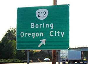
Recently selected: Legacy Parkway • Interstate 40 in Arizona • Thomas P. O'Neill Jr. Tunnel
April
[edit]
Recently selected: Legacy Parkway • Interstate 40 in Arizona • Thomas P. O'Neill Jr. Tunnel
May
[edit]
Recently selected: Interstate 189 • Legacy Parkway • Interstate 40 in Arizona
June
[edit]
Recently selected: South Dakota Highway 10 • Interstate 189 • Legacy Parkway
July
[edit]
Recently selected: U.S. Route 1 in Florida • South Dakota Highway 10 • Interstate 189
August
[edit]
Recently selected: Pennsylvania Route 144 • U.S. Route 1 in Florida • South Dakota Highway 10
September
[edit]
Recently selected: U.S. Route 550 • Pennsylvania Route 144 • U.S. Route 1 in Florida
October
[edit]
Recently selected: Interstate 70 in Maryland • U.S. Route 550 • Pennsylvania Route 144
November
[edit]
Recently selected: Blue Ridge Parkway • Interstate 70 in Maryland • U.S. Route 550
December
[edit]
Recently selected: M-15 centerline • Blue Ridge Parkway • Interstate 70 in Maryland
2012
[edit]January
[edit]
Recently selected: Big I snowman • M-15 centerline • Blue Ridge Parkway
February
[edit]
Recently selected: Oregon Route 58 • Big I snowman • M-15 centerline
March
[edit]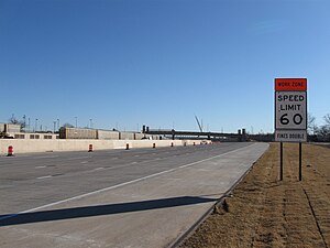
Recently selected: Delaware Route 82 • Oregon Route 58 • Big I snowman
April 1 (April Fool's Day)
[edit]
Recently selected: Interstate 40 in Oklahoma • Delaware Route 82 • Oregon Route 58
April
[edit]
Recently selected: Interstate 40 in Oklahoma • Delaware Route 82 • Oregon Route 58
May
[edit]
Recently selected: California State Route 1 • Interstate 40 in Oklahoma • Delaware Route 82
June
[edit]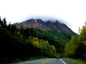
Recently selected: Mini Stack • California State Route 1 • Interstate 40 in Oklahoma
July
[edit]
Recently selected: Seward Highway • Mini Stack • California State Route 1
August
[edit]
Recently selected: U.S. Route 220 in Pennsylvania • Seward Highway • Mini Stack
September
[edit]
Recently selected: Interstate 5 in Oregon • U.S. Route 220 in Pennsylvania • Seward Highway
October
[edit]
Recently selected: New York State Route 431 • Interstate 5 in Oregon • U.S. Route 220 in Pennsylvania
November
[edit]
Recently selected: Maine State Route 102 • New York State Route 431 • Interstate 5 in Oregon
December
[edit]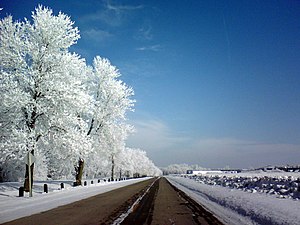
Recently selected: Rays Hill Tunnel • Maine State Route 102 • New York State Route 431
2013
[edit]January
[edit]
Recently selected: Lake Street (Cherokee, Iowa) • Rays Hill Tunnel • Maine State Route 102
February
[edit]
Recently selected: Washington State Route 410 • Lake Street (Cherokee, Iowa) • Rays Hill Tunnel
March
[edit]
Recently selected: U.S. Route 1 in Florida • Washington State Route 410 • Lake Street (Cherokee, Iowa)
April 1 (April Fool's Day)
[edit]
Recently selected: Interstate 90 in Montana • U.S. Route 1 in Florida • Washington State Route 410
April
[edit]
Recently selected: Interstate 90 in Montana • U.S. Route 1 in Florida • Washington State Route 410
May
[edit]
Recently selected: U.S. Route 23 in Kentucky • Interstate 90 in Montana • U.S. Route 1 in Florida
June
[edit]
Recently selected: U.S. Route 202 in Pennsylvania • U.S. Route 23 in Kentucky • Interstate 90 in Montana
July
[edit]
Recently selected: Utah State Route 24 • U.S. Route 202 in Pennsylvania • U.S. Route 23 in Kentucky
August
[edit]
Recently selected: Interstate 10 in Louisiana • Utah State Route 24 • U.S. Route 202 in Pennsylvania
September
[edit]
Recently selected: Ohio State Route 309 • Interstate 10 in Louisiana • Utah State Route 24
October
[edit]
Recently selected: Colorado State Highway 103 • Ohio State Route 309 • Interstate 10 in Louisiana
November
[edit]
Recently selected: M-28 and M-64 • Colorado State Highway 103 • Ohio State Route 309
December
[edit]
Recently selected: U.S. Route 19 in West Virginia • M-28 and M-64 • Colorado State Highway 103
2014
[edit]January
[edit]
Recently selected: California State Route 44 • U.S. Route 19 in West Virginia • M-28 and M-64
February
[edit]
Recently selected: U.S. Route 66 in Oklahoma • California State Route 44 • U.S. Route 19 in West Virginia
March
[edit]
Recently selected: U.S. Route 18/85 in Wyoming • U.S. Route 66 in Oklahoma • California State Route 44
April
[edit]
Recently selected: Florida State Road 826 • U.S. Route 18/85 in Wyoming • U.S. Route 66 in Oklahoma
May
[edit]
Recently selected: George Washington Memorial Parkway • Florida State Road 826 • U.S. Route 18/85 in Wyoming
June
[edit]
Recently selected: Interstate 440 (Tennessee) • George Washington Memorial Parkway • Florida State Road 826
July
[edit]
Recently selected: U.S. Route 201 • Interstate 440 (Tennessee) • George Washington Memorial Parkway
August
[edit]
Recently selected: U.S. Highway 74 • U.S. Highway 201 • Interstate 440 (Tennessee)
September
[edit]
Recently selected: U.S. Highway 30 • U.S. Highway 74 • U.S. Highway 201
October
[edit]
Recently selected: M-87 • U.S. Highway 30 • U.S. Highway 74
November
[edit]
Recently selected: Natchez Trace Parkway • M-87 • U.S. Highway 30
December
[edit]
Recently selected: Alaska Highway • Natchez Trace Parkway • M-87
2015
[edit]January
[edit]
Recently selected: U.S. Route 101 • Alaska Highway • Natchez Trace Parkway
February
[edit]
Recently selected: New Jersey Turnpike • U.S. Route 101 • Alaska Highway
March
[edit]
Recently selected: Maryland Route 197 • New Jersey Turnpike • U.S. Route 101
April
[edit]
Recently selected: Utah State Route 143 • Maryland Route 197 • New Jersey Turnpike
May
[edit]
Recently selected: Florida State Road 972 • Utah State Route 143 • Maryland Route 197
June
[edit]
Recently selected: U.S. Route 80 in California • Florida State Road 972 • Utah State Route 143
July
[edit]
Recently selected: New York State Route 32 • U.S. Route 80 in California • Florida State Road 972
August
[edit]
Recently selected: Interstate 5 in Washington • New York State Route 32 • U.S. Route 80 in California
September
[edit]
Recently selected: Iowa Highway 25 • Interstate 5 in Washington • New York State Route 32
October
[edit]
Recently selected: Hawaii Route 560 • Iowa Highway 25 • Interstate 5 in Washington
November
[edit]
Recently selected: M-77 • Hawaii Route 560 • Iowa Highway 25
December
[edit]
Recently selected: U.S. Route 550 • M-77 • Hawaii Route 560
2016
[edit]January
[edit]
Recently selected: New Hampshire Route 123 • U.S. Route 550 • M-77
February
[edit]
Recently selected: Texas State Highway 207 • New Hampshire Route 123 • U.S. Route 550
March
[edit]
Recently selected: Indiana State Road 26 • Texas State Highway 207 • New Hampshire Route 123
April
[edit]
Recently selected: Denali Highway • Indiana State Road 26 • Texas State Highway 207
May
[edit]
Recently selected: Wisconsin Highway 35 • Denali Highway • Indiana State Road 26
June
[edit]
Recently selected: Eisenhower Tunnel • Wisconsin Highway 35 • Denali Highway
July
[edit]
Recently selected: San Francisco–Oakland Bay Bridge • Eisenhower Tunnel • Wisconsin Highway 35
August
[edit]
Recently selected: Interstate 395 (District of Columbia–Virginia) • San Francisco–Oakland Bay Bridge • Eisenhower Tunnel
September
[edit]
Recently selected: West Virginia Route 28/55 • Interstate 395 (District of Columbia–Virginia) • San Francisco–Oakland Bay Bridge
October
[edit]
Recently selected: Arkansas Highway 7 • West Virginia Route 28/55 • Interstate 395 (District of Columbia–Virginia)
November
[edit]
Recently selected: Skyline Drive • Arkansas Highway 7 • West Virginia Route 28/55
December
[edit]
Recently selected: U.S. Route 66 in California • Skyline Drive • Arkansas Highway 7
2017
[edit]January
[edit]
Recently selected: Merritt Parkway • U.S. Route 66 in California • Skyline Drive
February
[edit]
Recently selected: U.S. Route 25 in South Carolina • Merritt Parkway • U.S. Route 66 in California
March
[edit]
Recently selected: Tennessee State Route 123 • U.S. Route 25 in South Carolina • Merritt Parkway
April
[edit]
Recently selected: Colorado State Highway 96 • Tennessee State Route 123 • U.S. Route 25 in South Carolina
May
[edit]
Recently selected: County Highway 98 (Jackson County, Alabama) • Colorado State Highway 96 • Tennessee State Route 123
June
[edit]
Recently selected: McClure Tunnel • County Highway 98 (Jackson County, Alabama) • Colorado State Highway 96
July
[edit]
Recently selected: Nebraska Link 53C • McClure Tunnel • County Highway 98 (Jackson County, Alabama)
August
[edit]
Recently selected: Puerto Rico Highway 52 • Nebraska Link 53C • McClure Tunnel
September
[edit]
Recently selected: Interstate 75/85 in Georgia • Puerto Rico Highway 52 • Nebraska Link 53C
October
[edit]
Recently selected: Illinois Route 92 • Interstate 75/85 in Georgia • Puerto Rico Highway 52
November
[edit]
Recently selected: Kettle Moraine Scenic Drive • Illinois Route 92 • Interstate 75/85 in Georgia
December
[edit]
Recently selected: Rhode Island Route 216 • Kettle Moraine Scenic Drive • Illinois Route 92
2018
[edit]January
[edit]
Recently selected: North Dakota Highway 21 • Rhode Island Route 216 • Kettle Moraine Scenic Drive
February
[edit]
Recently selected: U.S. Route 1 in the District of Columbia • North Dakota Highway 21 • Rhode Island Route 216
March
[edit]
Recently selected: K-57 (Kansas highway) • U.S. Route 1 in the District of Columbia • North Dakota Highway 21
April
[edit]
Recently selected: Arizona State Route 98 • K-57 (Kansas highway) • U.S. Route 1 in the District of Columbia
May and June
[edit]
Recently selected: Colonial Parkway • Arizona State Route 98 • K-57 (Kansas highway)
July
[edit]
Recently selected: California State Route 190 • Colonial Parkway • Arizona State Route 98
August
[edit]
Recently selected: U.S. Route 219 in Pennsylvania • California State Route 190 • Colonial Parkway
September
[edit]
Recently selected: Nevada State Route 447 • U.S. Route 219 in Pennsylvania • California State Route 190
October
[edit]
Recently selected: Lincoln Highway in Iowa • Nevada State Route 447 • U.S. Route 219 in Pennsylvania
November
[edit]
Recently selected: New York State Route 421 • Lincoln Highway in Iowa • Nevada State Route 447
December
[edit]
Recently selected: M-6 (Michigan highway) • New York State Route 421 • Lincoln Highway in Iowa
2019
[edit]January and February
[edit]
Recently selected: Utah State Route 12 • M-6 (Michigan highway) • New York State Route 421
March
[edit]
Recently selected: U.S. Route 13 in Virginia • Utah State Route 12 • M-6 (Michigan highway)
April
[edit]
Recently selected: Interstate 84 in Idaho • U.S. Route 13 in Virginia • Utah State Route 12
May
[edit]
Recently selected: U.S. Route 202 in Pennsylvania • Interstate 84 in Idaho • U.S. Route 13 in Virginia
June
[edit]
Recently selected: U.S. Route 93 Alternate (Nevada) • U.S. Route 202 in Pennsylvania • Interstate 84 in Idaho
July
[edit]
Recently selected: Maryland Route 36 • U.S. Route 93 Alternate (Nevada) • U.S. Route 202 in Pennsylvania
August
[edit]
Recently selected: Interstate 70 in Utah • Maryland Route 36 • U.S. Route 93 Alternate (Nevada)
September
[edit]
Recently selected: Puerto Rico Highway 511 • Interstate 70 in Utah • Maryland Route 36
October and November
[edit]
Recently selected: New Mexico State Road 124 • Puerto Rico Highway 511 • Interstate 70 in Utah
December
[edit]
Recently selected: Pennsylvania Route 33 • New Mexico State Road 124 • Puerto Rico Highway 511
2020
[edit]January
[edit]
Recently selected: Interstate 40 in Arizona • Pennsylvania Route 33 • New Mexico State Road 124
February
[edit]
Recently selected: Interstate 68 • Interstate 40 in Arizona • Pennsylvania Route 33
March
[edit]
Recently selected: Interstate 10 in Texas • Interstate 68 • Interstate 40 in Arizona
April
[edit]Recently selected: Interstate 80 in Nevada • Interstate 10 in Texas • Interstate 68
May
[edit]
June
[edit]July
[edit]August
[edit]September
[edit]October
[edit]


